Carol writes: Our days in Borrego Springs morphed into a relaxing routine of long morning walks on dirt trails around the periphery of the golf course,


and into the quiet streets of the Roadrunner senior living community that abutted our campground. During our daily walks, we played a game of hunting for errant golf balls that lay hidden in the dry vegetation outside the boundaries of the golf course.


The “Anza” of Anza-Borrego Desert commemorates Juan Bautista de Anza, a captain in the Spanish Army who was one of the first European explorers to travel through this desert while seeking a land route from Mexico to northern California.

In Spanish the word “borrego” means roughly “yearling lamb,” referring to the somewhat rare desert bighorn sheep that inhabit this desert.
 |
| ANZA |
 |
| BORREGO |
+
Coyote Canyon was the route by which the Anza expedition moved slowly northwest through the Borrego Valley in 1774.

Undoubtedly, the view that surrounded Anza and his men had not changed all that much in nearly 250 years!

We took time to savor majestic ocotillo (some with brilliant red blooms from a recent rain) and their little cholla cactus neighbors.


In the southeastern part of the park, the Fish Creek Canyon 4-wheel drive trail led us to another adventure-filled day.

An unusual geologic feature called an “anticline” was the star of the canyon.
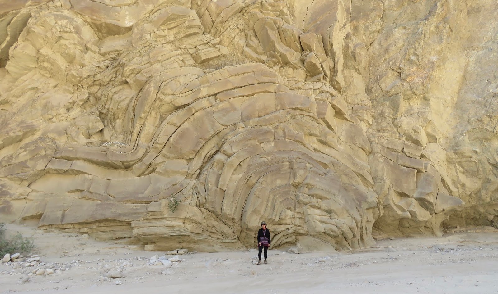
This anticline feature was formed in a matter of seconds when a sudden landslide in an ancient sea pushed horizontal layers of marine sediment into irregular folds which subsequently solidified.
The road through the canyon was lined by dramatic canyon walls,

then opened out into a wide sandy wash surrounded by amazing geological works of art.


We had read about the so-called sandstone-carved “wind caves” in Coyote Canyon, but locating the trail leading to the caves was more challenging than we expected. After a couple of hours of wandering around, we spotted the trailhead to the wind caves.

It was a fairly easy climb to the top,

where we took our turn getting vanity shots.


I was relieved when we finally negotiated a particularly rocky part of the trail coming down, as the downhill always foreshadows the most potential mishaps for the knees.

On the outskirts of Borrego Springs on a private parcel of land called Galleta Meadows, a menagerie of free-standing metal sculptures has attracted visitors from far and wide.

These live-size metal creatures depicting animals,


historical humans,


and a few imaginary beasts of fantasy
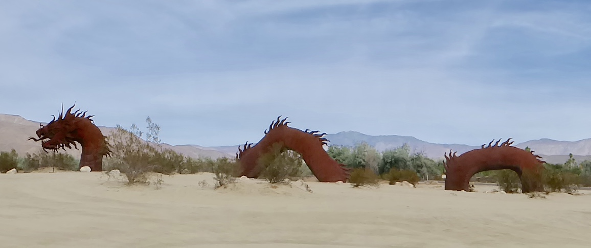


looked so natural in the desert landscape.
Photography was pure joy, and whimsical pics were irresistible…


The old mining district town of Julian is famous for the quality and variety of its apple crop. For quite a different reason, Julian has held a sweet spot in my heart for over 40 years. Back in the 70s, Al brought me to Julian and nearby Cuyamuca Rancho State Park on one of our early dates. I was being introduced to hiking and had a brand new pair of hiking boots that I wanted to break in on our first hike together. In the state park we found the peak that we climbed on that day so long ago, just as we remembered it!

Oh… and a freshly baked Julian apple pie rode back with us to Borrego Springs…
Our Borrego Springs campground was completely booked for the Thanksgiving weekend. The dry, cloudless days of the past 3 weeks continued their run. Thousands of campers and dune buggy enthusiasts descended upon Borrego Valley, notably at the Ocotillo Wells State Recreational Vehicle Area.

While passing through Ocotillo Wells at the end of our day at Fish Creek, we were flabbergasted at the air quality as we approached the main highway! The dust raised by racing off-road vehicles had created terrible visibility on busy Hwy 78. At the time Al and I remarked about how dangerous road conditions were…
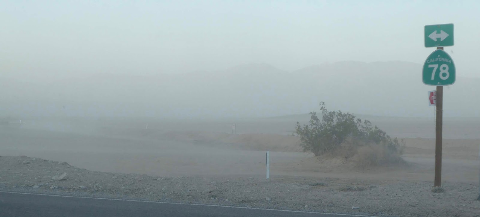
Tragically, two hours after we passed through dust-choked Ocotillo Wells, a car crash involving two trucks on Hwy 78 proved fatal for both drivers.
Which brings me to a few final comments on life and play in the desert…
The old way of life in Borrego Springs has come to a crossroads. The town water supply is headed toward critical levels because the aquifer is being depleted faster than it can be recharged naturally. Residents have been warned that they will be asked to cut water use by 75% or face having their only water source run dry.
Agriculture businesses are facing the reality of being forced to go fallow.
Difficult decisions lie ahead on how to deal with the thirsty green lawns of the golf resorts, the businesses that Borrego Springs relies on to bring in tourist dollars, the main source of the town’s revenue.
As far as choking air pollution goes… I’ll just say that corralling recreational vehicle use to an area set aside by the state hasn’t solved a darn thing! The atmosphere has no fences! Limiting user numbers would appear to be the least harsh solution, short of banning off-road activities altogether.
The Anza-Borrego Desert was a truly wonderful locale for serious down time for us. However, it was sad to learn that a plummeting aquifer level and unhealthy recreational dust pollution are now bumping up against the timeless Anza-Borrego Desert way of life.