“If you want to see what man made, go East; if you want to see what God made, go West.” Unknown
Carol writes: In one of our conversations with a Ouray resident about our travels recently, we mentioned that our next campground would be in Olathe, Colorado. His reply was, “What possible reason would you want to visit Olathe?” Hmmm, obviously, he didn’t have a high opinion of Olathe.
Nevertheless, there was bit of method to our madness.
 |
| Internet Photo |
First of all… we looked forward to the “agriculture champion”of this part of western Colorado—Olathe Sweet Corn!
Because of the high sugar content genetically bred into each variety of Olathe Sweet Corn, this corn stores poorly and must be eaten fresh. On our first day in town we went to a local fresh vegetable stand and bought half a dozen ears. It was fortuitous that we had stocked up because the next day we received a phone call from good friends Dick and Maria. They wanted to pay us a visit and were looking forward to some of that famous sweet corn!

The corn was sweet and delicious, and it was a blast having overnight visitors… sharing a movie, good times, friendship and lots of laughter.
Maria and Dick were awarded kudos for being such fast learners at “Carbles!”

The second reason for our selection of Olathe as a basecamp was because of its closeness to the entrance of the Black Canyon of the Gunnison National Park.

There were three ways to appreciate the Black Canyon of the Gunnison:
- by water on a boat excursion with the Park Service
- driving the rim by car and stopping at viewpoints
- hiking 1600 to 1800 feet down into the canyon by means of 1 of 3 draws… and hiking back up!
We decided to start with the first option since, for us, the third option wasn’t ever going to happen.
After safety checks on a brand new boat, we were delighted when the Park Service resumed boat excursions for the summer on the Gunnison River.

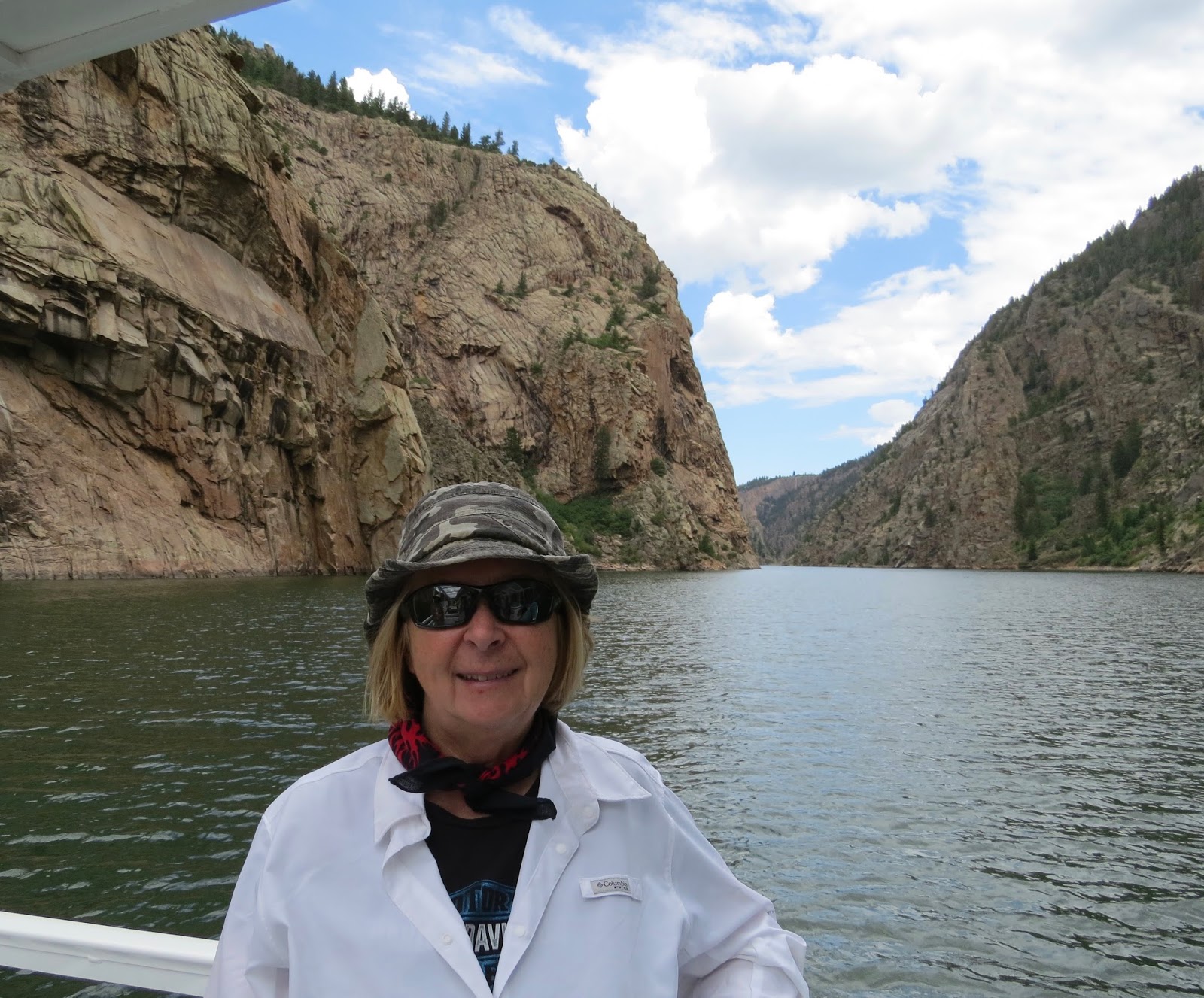
After an easy hike down to a deep part of the river way upstream, we took a 7-mile boat excursion with the Park Service down the Gunnison River into the Black Canyon.

In no time at all we were fenced in on both sides by spectacularly high canyon walls.
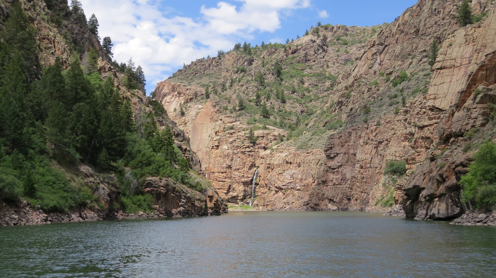
One of the most scenic sections of the river was the view of the iconic 700-ft Curecanti Needle that was the inspiration for the logo of the old Denver and Rio Grande Railroad that used to operate in the canyon before it was dammed up.


The ranger’s most informative commentary about the geology and early history of the canyon made the boat excursion most worthwhile.


Since we had the luxury of time, we spent two days on the rim of the canyon—one day on the South Rim and another day on the less populous North Rim.

We hiked Warner Point Trail, the most distant point on the South Rim, and were delighted with outstanding views into the fertile green agricultural valley far below.

At Warner Point we got our first sample of just how deep and magnificent this canyon was

on a trail through a “JP Forest” of junipers and pinyon pines.

The viewpoints by car ride along the South Rim were dizzying!

The geologic wonder of pegmatite seams in the 1800-ft canyon walls soaring high above the river below created a so-called “painted wall.”

At a few places the canyon walls had draws that were negotiable for experienced hikers to access the river and a handful of campgrounds 1600-1800 ft below.

While the South Rim certainly did not disappoint us with its grandeur, the less travelled North Rim was even more thrilling.

The name of the Exclamation Point Trail on the North Rim speaks for itself.

We managed to get a selfie

at a viewpoint where we felt safe enough to pose with our backs to the edge of the canyon. The North Rim canyon overlooks were positively nerve-racking. We both found ourselves stepping ever so timidly toward the railing…

The western slope of the Colorado Rockies is very dry, and it is only because of irrigation that the Uncompahgre and Gunnison river valleys of Delta, Montrose and Olathe, at the foot of the Grand Mesa,

have become important agricultural centers of Colorado. In 1905 a six-mile tunnel was literally carved through a nearby mountain so that precious Gunnison river water could be transported to create those awesome green fields of sweet corn and all the other crops.

The confluence of the Uncompahgre and Gunnison rivers is in Delta.

During our visit both rivers were running very rapidly—great for kayakers and surfers! Apparently the “river surfing” we saw in Gunnison wasn’t all that unusual.


Our verdict was that Olathe proved to be a pretty nice place to hang out for a couple of weeks. We were most impressed with the rivers, canyons, and agricultural richness of this part of western Colorado. The uncommon raw beauty of the Black Canyon of the Gunnison and the challenge it posed to human exploration were the essential elements of its appeal to us.
“Travel makes one modest. You see what a tiny place you occupy in the world.” Gustave Flaubert
Beautiful pics!
ReplyDelete